Your window on local traffic

Traffic data for better streets.
Get high quality, continuous and real-time data, in collaboration with local citizens.

What is Telraam?

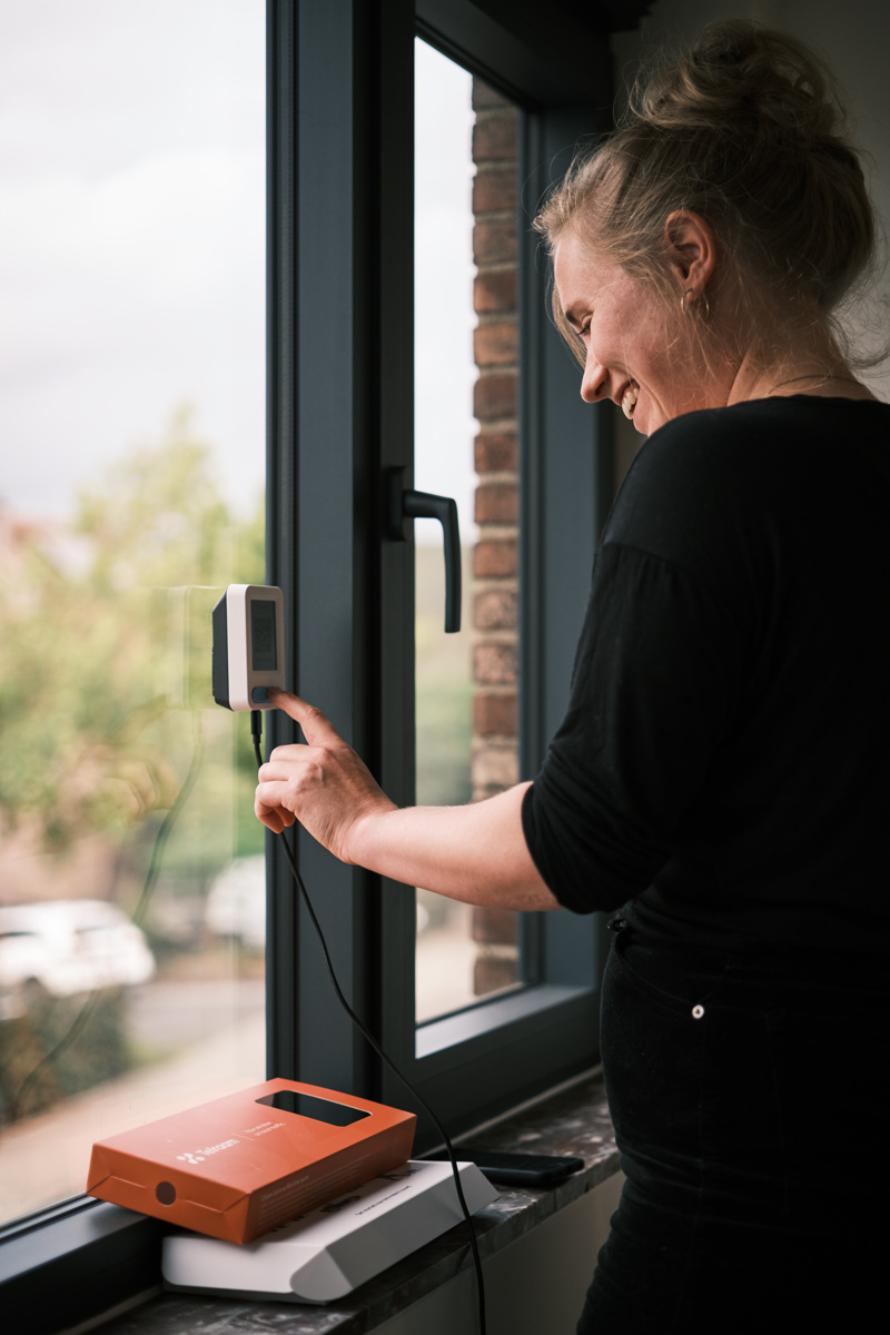
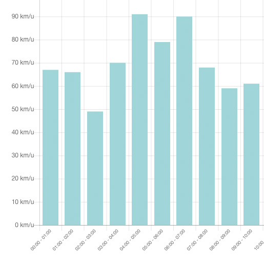
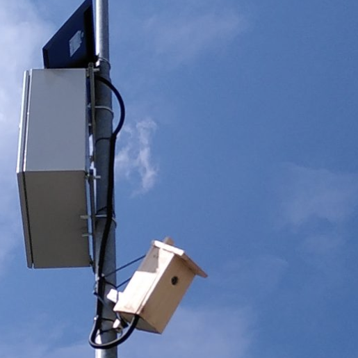
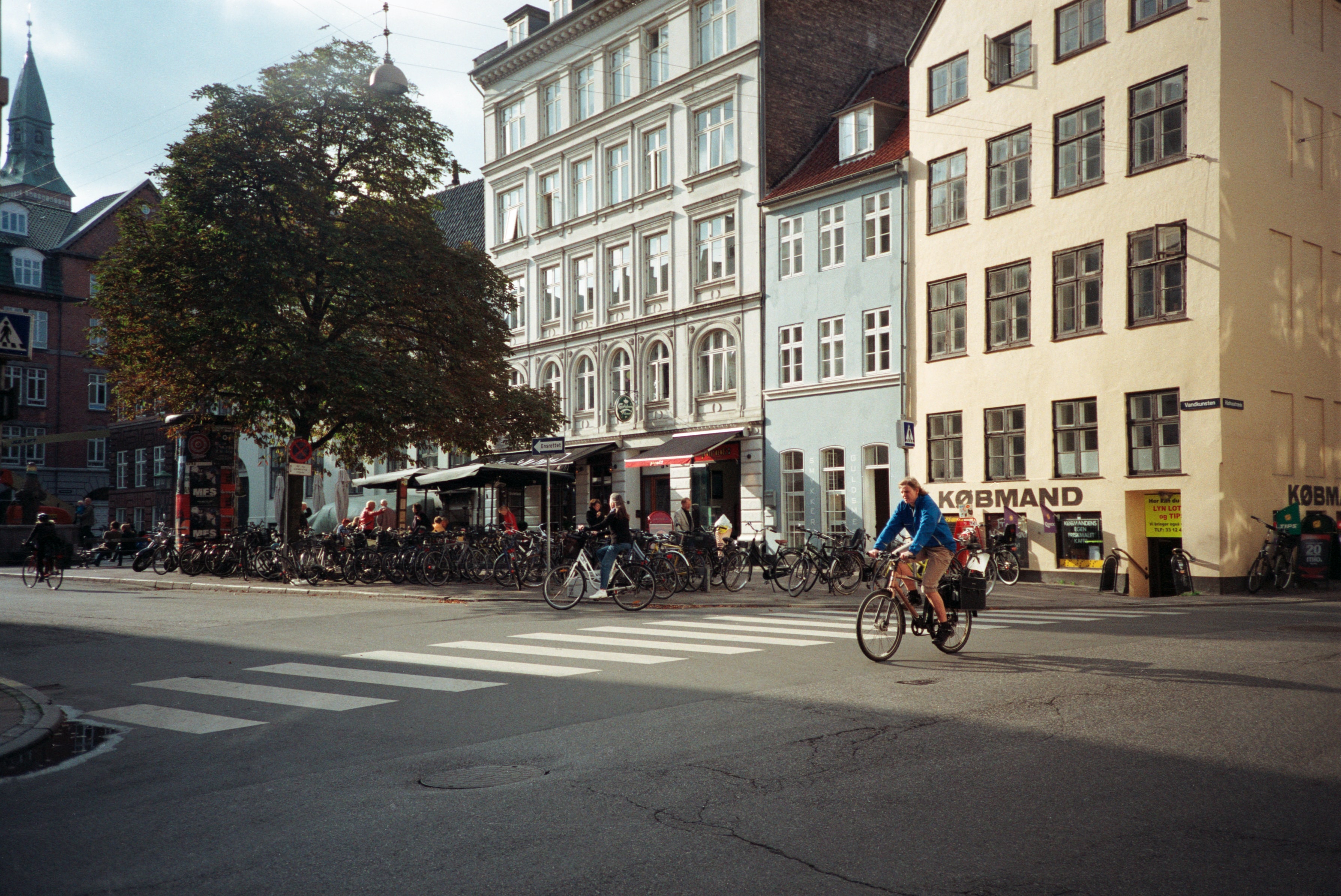
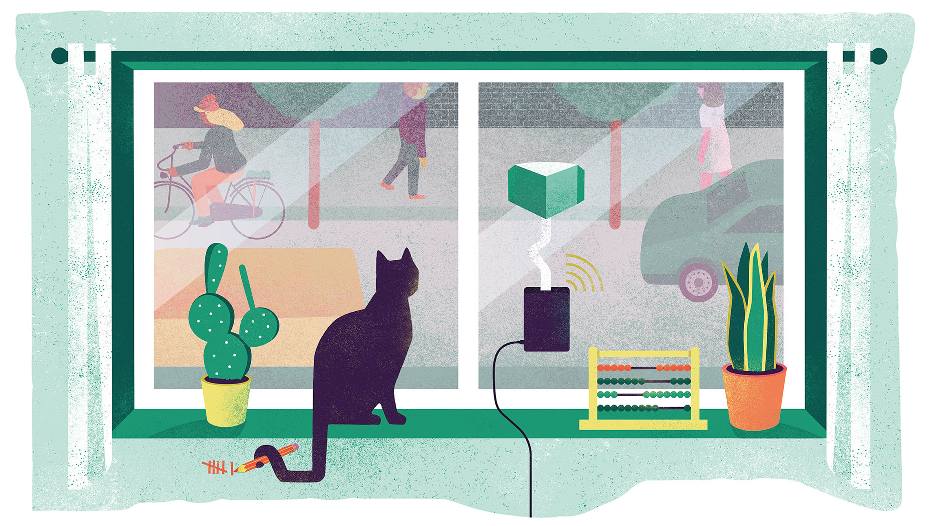
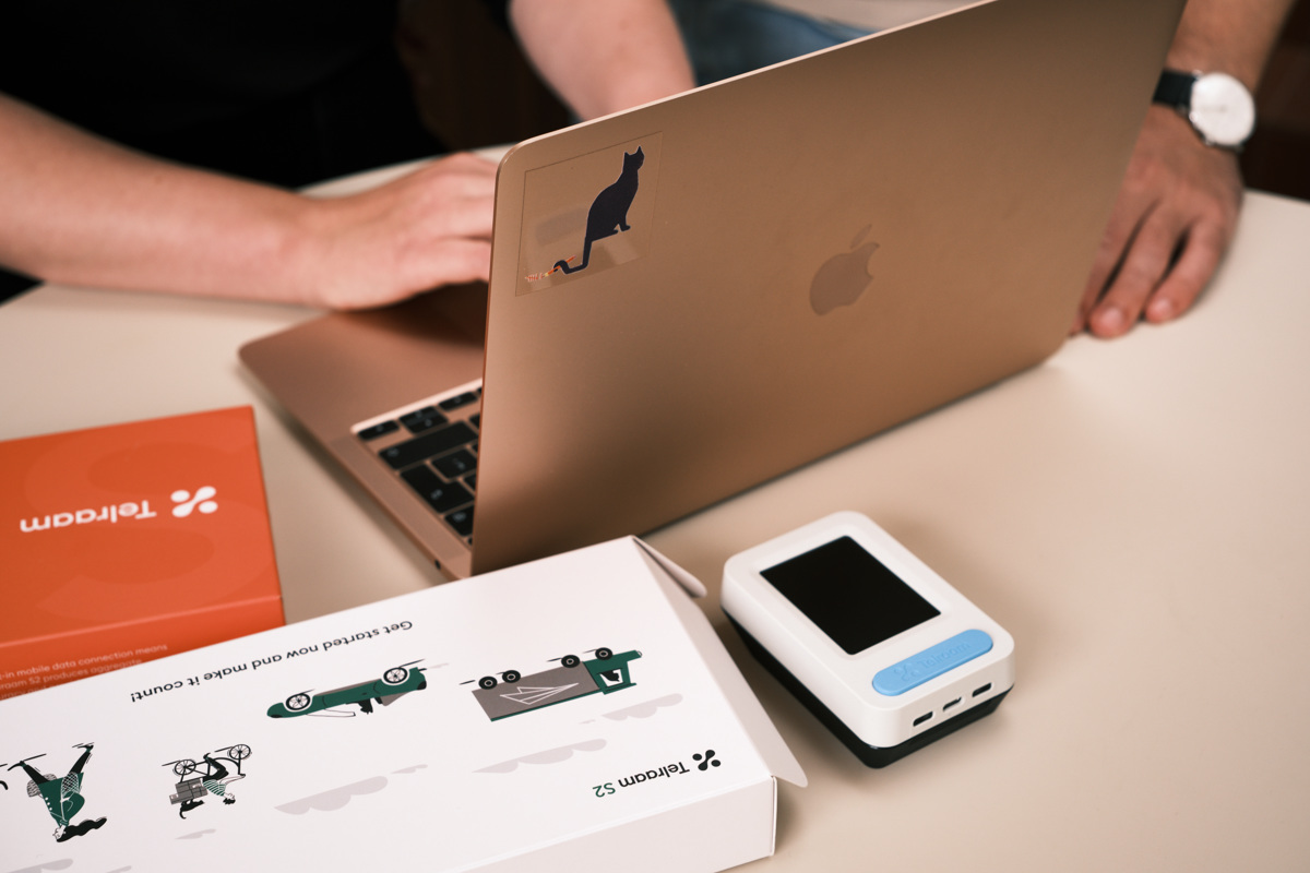
Telraam is your citizen-powered solution for collecting multi-modal traffic data with a purpose-built, affordable, and user-friendly device.

Our Telraam sensor continuously monitors a street from a citizen’s window, providing crucial data on various modes of transport, including motorised vehicles, cyclists, pedestrians, and more. Telraam networks also create the opportunity for dialogue between traffic planners, local authorities and their most affected communities: the citizens who live on - and use - these streets, by turning traffic counting into an open and accessible citizen science project.

Whether you are a local resident, a campaigner, an employee of a public or private organisation, or work for a government agency, a Telraam project delivers reliable data to help you achieve your goals.
Rat running. School runs. Road safety. Air pollution. Active Travel. Complex issues require quantitative traffic data. How to get that?
Client
Telraam is your citizen science solution. We provide a user friendly web based tool, best practices for recruiting and an award winning api.
Telraam

Inform the debate

Complex issues require quantitative traffic data to enhance our understanding and to find better solutions.

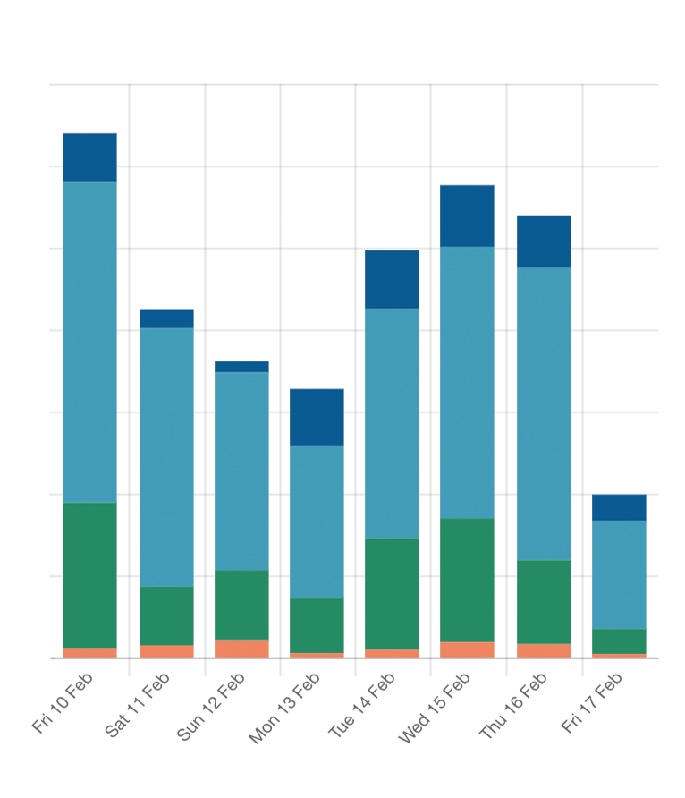
Gathering data to get a full picture of transport, leisure, and social activity for a network of streets is often impossible or very expensive with traditional tools like pneumatic tubes or manual counts.

Telraam sensors and networks provide a solution for citizens and their local representatives.

Traffic data for better streets

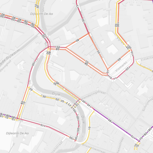
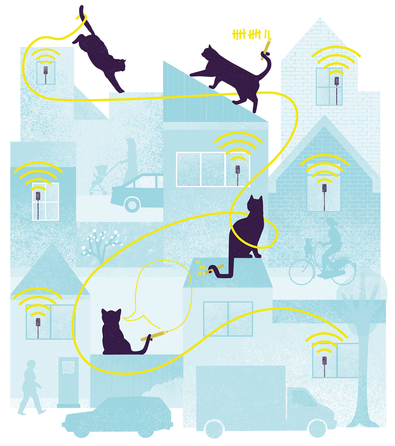
Telraam creates custom networks of sensors that leverage the knowledge and access of local residents, using artificial intelligence (AI) technology to deliver consistent, timely, quality data for more efficient and effective infrastructure, traffic flow and traffic management plans.

Involving citizens and publishing open data brings researchers and policy makers into contact with local residents, creating the potential for interaction, dialogue, co-creation, and other forms of participation.

"By analysing the V85 standard, we get an indication of the best times for performing speed checks. These checks are used to achieve a change in the behaviour of the road users."

— Lotte Demeestere
Mobility expert for the city Kortrijk
"Telraam provides not only insights through data but also understanding through interaction with residents, and the local and provincial governments."

— David Tailleur
Teamcoach neighbourhood Police Lubbeek

How does the Telraam S2 device work?

Telraam S2 is our newest device. It counts and classifies road users, providing anonymous, aggregate data per traffic mode and per direction with a 15 minute resolution. In addition, it derives an estimated speed distribution (and the V85 speed) for cars.

Telraam S2 uses specially-trained AI and a proprietary tracking algorithm to detect, classify, and count road users with high precision in a wide range of typical street environments. Citizens place a Telraam sensor in their window, and the data that is collected can be shared with local authorities and policy makers as Open Data.

Telraam devices can be set up by citizens on their individual streets, or by local campaign groups and government authorities who fund citizen networks to gather local traffic data.

Read more about the S2 device

What does a Telraam S2 device do?

The Telraam S2 is a custom device that sits in your window. Once connected, you don’t need to do anything, just watch the counts as they happen.

The Telraam S2 has a low resolution camera (for privacy), an AI chip for detecting and categorising street users, and a built in mobile data connection that relays aggregated, anonymous data to the Telraam servers. The device simply needs to be powered and mounted on the inside of an upper-floor window with an unobstructed view over the street.

Make your view count

Ready to start collecting your own data? Read our Start counting guide to see how easy it is to get going, and how to set up your own counting network.

In no time you will have a detailed insight report on all the activity on your street, neighbourhood or city.

It’s your view. Make it count!

Use Cases

Traffic models

Use Telraam to calibrate traffic models and provide insights into traffic volumes at a local level.

Check out Traffic scout for a ready-made application built on top our api.

Safer Streets

The main causes of danger are motor vehicles, so it stands to reason that we need to measure how these use the street, in terms of modal share, volume and speed.
Read more

Clean Air

Maps of air quality can highlight a link between poor air quality and high traffic levels, but to reduce car journeys you need to know how many cars are actually using the road, and when.
Read more

School Streets

Arriving and leaving a school should be a safe, healthy and enjoyable experience for children, parents and local residents. Measure the implementation and success
Read more
Do not hesitate to drop us a message. We love to hear from you.

Get in touch