School Street Success in Strasbourg: 84% Traffic Reduction and Safer Routes
How data-driven planning created a calmer, safer, and more active school zone at Rue Saint-Dié.
Key information
- Sensor and data hosting
- Sensor installations
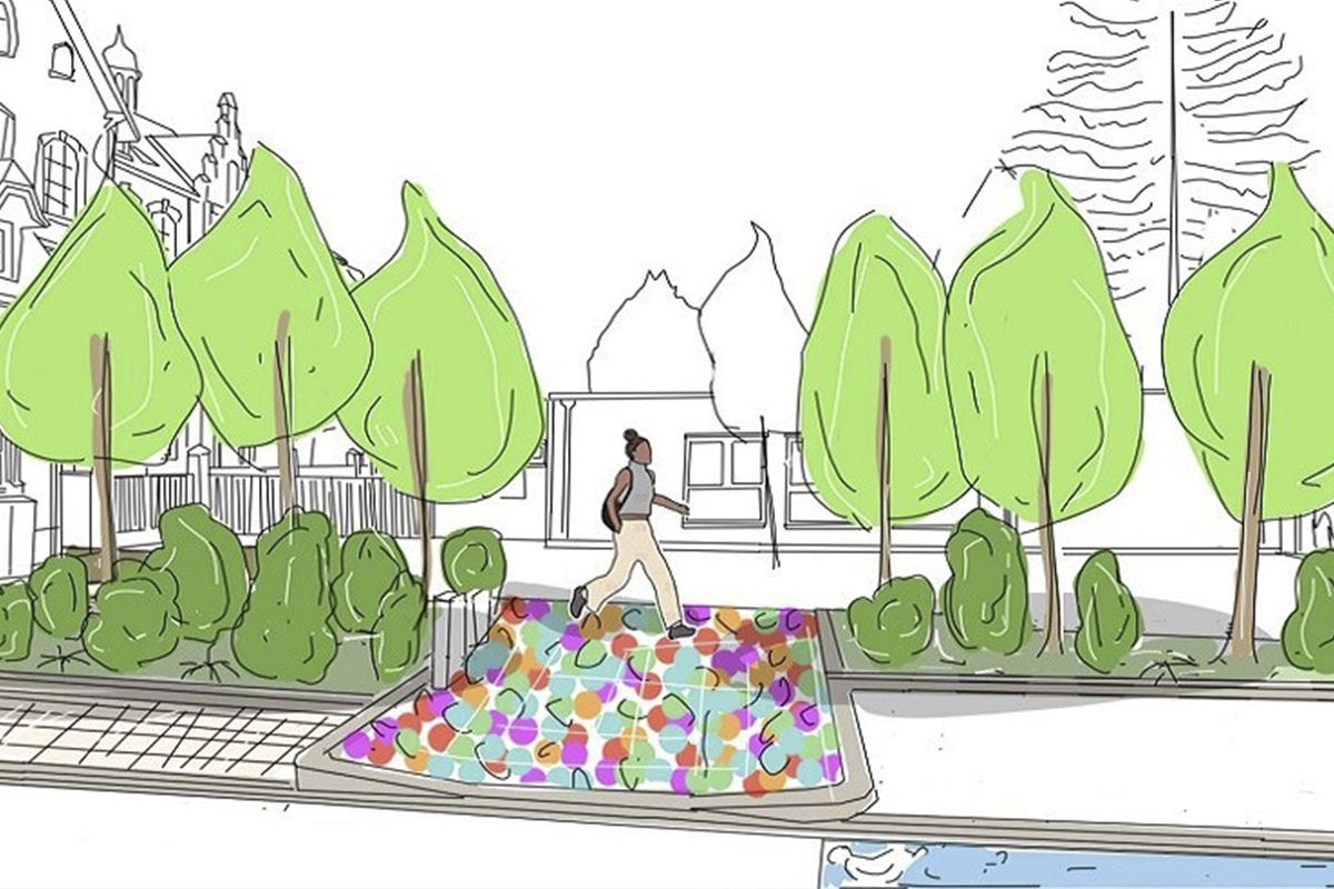
- School street
The City of Strasbourg aimed for more than just a momentary snapshot; they needed continuous, multimodal data to track the long-term impact of their intervention. The Telraam network was essential for evaluating the project across its four distinct phases—from baseline (T0) to final layout (T2) and back-to-school (T3). The primary objectives, articulated as key questions, were to confirm:
- Traffic Reduction: Was there a "flattening" of car peaks at morning and afternoon rush hours?
- Speed Calming: Did the measure succeed in lowering car speeds?
- Active Travel Uptake: Was there a positive evolution in active modes like walking and cycling?
- Neighbourhood Effects: Did the school street cause any disruptive traffic displacement on adjacent streets?
By relying on Telraam's real-time, open-access data, the city was able to definitively answer these questions
Our role
Telraam supported Strasbourg by providing the technology and the framework for a robust, multi-phase data collection effort. The implementation was a participatory success, with four volunteer families in the Schluthfeld school sector hosting the Telraam devices between January and September 2025.
This setup ensured the city could monitor traffic across the crucial stages:
- T0 – Baseline: February 3–24
- T1 – Temporary Setup (with barriers): February 24 – May 18
- T2 – Final Layout: Starting June 16
- T3 – Back-to-School: September 1–15
This detailed, phased monitoring, combined with the accessible data, allowed the city to directly translate raw measurements into precise, actionable insights about the success of the street transformation.
Outcome: a Real Change on the Streets
The Strasbourg school street project was a definitive success, validated by the Telraam data.
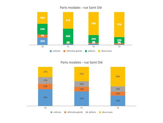
Sharp Traffic Reduction and Calmer Speeds - On the school street section of Rue Saint-Dié, the effect was dramatic:
- A reduction of 84% of weekday car traffic, dropping from 154 cars/day (T0) to just 25 after the final layout (T2).
- The intervention successfully "flattened" the car peaks typically seen at 8 AM and 4 PM (school rush hours).
- Car speeds calmed significantly, with the proportion of vehicles traveling below 30 km/h rising from about two-thirds in February to nearly five out of six drivers in June.
Boost in Active Travel - The safer environment translated into a stronger place for active modes:
- Pedestrian activity rose sharply during the temporary phase (from 249 to 461/day) before stabilizing at 228/day, with even more switching to cycling after the final works.
- Cycling showed sustained growth, rising from 269 cyclists/day (T0) to 656/day (T2), with the 'A l’Ecole à Vélo' Challenge playing a supporting role.
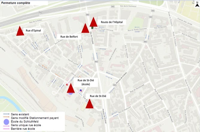
No Significant Displacement - Crucially, the data confirmed that the traffic reduction was not simply shifted to adjacent streets.
- The rest of Rue Saint-Dié upstream also saw a reduction of 86% in weekday traffic.
- Rue d’Epinal saw an increase of +34%, but this represented only an additional 30 cars/day (from 82 to 110).
- Rue de Belfort saw a +62% increase, but the street remains a local access road with a still low, fluid traffic volume of about 1,800 cars/day.
- The main thoroughfare, Route de l’Hôpital, saw stable traffic overall.
This conclusive evidence helped Strasbourg validate a successful intervention that creates safer, more active neighbourhoods.
Want to know more about this project?
Feel to free to get in touch.